
Hills and vales of the Stroud valleys
Stroud developed as a town in the 13th century at the junction of five valleys, where they coalesced and then broke through the dramatic Cotswold hills, flowing westwards against the grain or slope of the underlying carboniferous limestone.
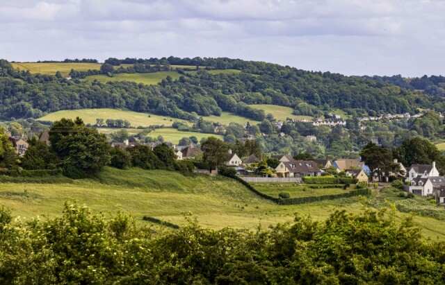
Today I drove up towards Randwick from where I’ve looked back over the ridge, between two of the valleys, called Whitsehill, towards the distant hilltops which form the south facing slopes of the Golden Valley along which the main River Frome flows. The other four valleys really only have large streams which created them – the Ruscombe, Painswick, Slad and Nailsworth streams.
The mass of trees on the far hilltop is called Park Wood, which was established before the 16th century as a 'deer park’. It has remained as a managed woodland ever since, mostly as a property within the huge Lypiatt Manor, a grand estate which was broken up into small parcels of farms, fields, woodlands and buildings, mostly agricultural rather domestic dwellings, in the 1920s.
The view from my window as I look up from my desk is of the westernmost end of Park Wood, where it adjoins the Horns valley. The line of modern houses running along the valley beneath Park Wood marks the spring line between one of the strata of limestone above and Fuller's Earth, a clay band, below. these springs flow all year round. It is called Thrupp Lane and is an ancient track which was originally used for horse drawn coaches, and carts, as it ran above the sticky clays found in the lower parts of the valleys. From the Middle Ages, there were daily coaches from Stroud to London, which were important for carrying the cloth for which the local area had become famous for. Some is even made here now, particularly for covering snooker tables and tennis balls.
Comments
Sign in or get an account to comment.


