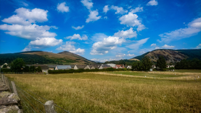
Innerleithen
Didn't get away bright and early like I wanted to. Hung up the washing, then left on the bike about 10. It feels pretty warm, and the sun is very strong. Factor 50 has been applied to arms,legs and face (and back of neck). I head south in to a pretty strong south wind.
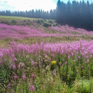
I decide to do an anticlockwise route. So its along the Seafield Moor road, down to Auchendinny, an the long climb up Westerhaugh to the Top Gear road, over Mount Lothian. I turn right at Upper Side to head south. This turns in to the Falla Toll road. At the switchbacks, there is a whole load of Rose bay willow herb in flower (Extra 1)
Going downhill in to the wind isn't so bad as I cycle to Eddleston. It feels quite fast, but the wind is still there.I turn off at the sign for the Meldons and Lyne. the A703 was quite busy. Its quite warm as I climb up to the pass and head between the Meldons, then descend to the A72.
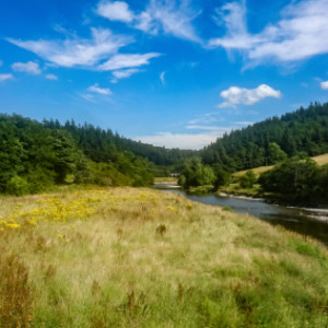
I head east for a wee while along the A road, the turn off on to the Cademuir road. It passes over the River Tweed (Extra 2) and loops around Cademuir hill and in to Peebles. Quite a stong wind until I head north in to Peebles. I have an energy bar.
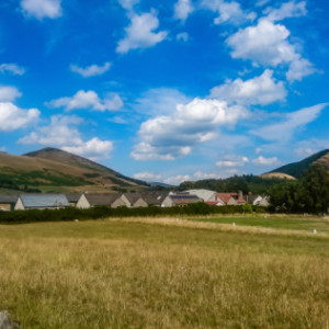
The B7062 climbs slowly, descends before climbing again and descending to the level of the River Tweed. and skirts the Cardrona forest. Its nice and shady. In the open parts of the road, the wind is in my face. At Traquair,I turn left on to the B709. I follow this north and over the River Tweed. I stop briefly to take a shot (Extra 3) of Lee Penn (Left) and Kirnie Law (Right), which loom over Innerleithen.
For the next few miles there won't be any tree cover. The thermometer and average speed are the same 24.7. The A709 heads through Innerleithen (with a wee bit on the A72) heading north through some remote countryside. There are a few other cyclists on this road as it forms part of National Cycle Route 1. From Innerleithen it climbs. The bottom is 155m above sea level, and the first 9km climbs up to Dewar Gill and the Piper's Grave (blipped before) at 365m asl. This point, the wind is not hindering or helping me. There's a short descent. The B709 heads to Heriot at the bottom (still 290m asl). I follow the B7007 from here up, yes another climb, to the Granites, 404m asl.Just after the top is a great viewpoint, Extra 4, showing the Pentland Hills and Arthur's Seat. The thermometer says 31 deg C. Hot. I have enough to drink to get me home though.
From here is a long descent.The B road has a nice road surface, but I have to turn off the B road to head for Middleton. A minor road covered in gravel that heads for Middleton. From Middleton, its another minor road heading west then north through Castleton to the Top Gear road. Even though I'm heading west, the wind was still in my face.Over the Braidwood Bridge and on to the road to Carrington and Bonnyrigg. A bumpy road, with the advantage most of it is downhill.
Bonnyrigg is ok, but there is a diversion required due to road works. Then a short sharp descent to Lasswade. This is the home stretch. West on the A768, then north on the Lasswade road. Home is then along Captains road and the B701 back to Fairmilehead. The final climb along Frogston Rd is in to the wind, and on a poor road surface. I make it up to the top and home.
A long ride, A Gran Fondo in a forno. 112.78km, just over 70 miles
The whole route can be at Relive here.
A quiet afternoon recuperating from the ride. Coffee and chocolate bar never tasted so good. Perhaps I should have done it clockwise.
Comments
Sign in or get an account to comment.


