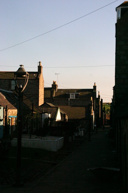
Standing in the shadows
This shadowy place is not a dark as it looks.
It is an area of Aberdeen called Footdee.
Footdee is an area of Aberdeen, Scotland known locally as "Fittie". It is an old fishing village at the east end of the harbour. The name is actually folk etymology. Far from being "Foot of the Dee/Fit o the Dee", it is actually a corruption of a former dedication to a "St Fothan".
The area has had a settlement as far back as the Medieval times and the first recorded reference to the area of Fittie was in the year 1398. This village was slightly further North than where Footdee is now located. It would have been near to where the St Clement's Church is located. The following is taken from Historic Scotland's Information Supplementary to the Statutory List:
' Footdee is a particularly interesting example of a planned housing development purpose-built to re-house Aberdeen's local fishing community. Laid out in 1809 by John Smith, then Superintendent Of The Town's Public Works. Smith went on to establish himself as one of Aberdeen's key architects. Occupying an isolated spit of land to the SE of Aberdeen's city centre, its regimented squares have been described as `a cross between the neo-classical aspirations of Aberdeen and the close-knit fishing communities of the north-east'.
On an 1828 map, the new housing squares were specifically labelled 'Fish Town'. 'Footdee' referred to the larger area from St. Clement's Church to 'Fish Town'. Later, the name 'Footdee' was erroneously used to refer specifically to the housing squares, with 'Fish Town' becoming forgotten.
Comments
Sign in or get an account to comment.


