Blaueis
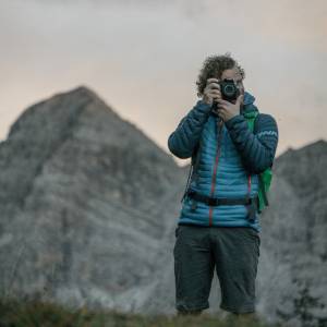
Today Lena and I went for a two-day hiking tour to Berchtesgaden National Park. We planned to go up to Blaueishütte, a alpine hut at the foot of Hochkalter, on the first day and proceed up to Hochkalter summit on the next day. The first day was therefore an easy two-hour or so hike to the hut, which is scenicly located just below the Blaueis ("blue ice") glacier, the Alps northermost glacier and one that is amongst the most endangered by climate change.
The blip shows the remains of Blaueis glacier. It is enframed by Blaueisspitze, Hochkalter, Kleinkalter, and Rotpalfen (clockwise).
The Hochkalter (2,607 meters), the 5th highest mountain in Germany and the highest of the mountain range around Blaueis, is our target for tomorrow. The plan is to climb hike up to Schöner Fleck, across Kleinkalter, up to Hochkalter, and down on the other side through Ofental ("oven valley") back to the car in Hintersee. I'm a little afraid that Lena (she was in charge of tour planning this time) is overestimating my skills this time - I'm in rather good shape, but I'm not much of a climber.

Comments
Sign in or get an account to comment.


