
Old Maps
Last week I blipped a booklet on The Orchards of Arnside and Silverdale and reported that Mrs.K. was working on a new edition.
As part of this she has been researching the many orchards that used to be present in Arnside.and she
has bought an Ordnance Survey map of Westmorland for 1862.
You can look at and buy these in several places but we have used the outstanding online service offered by the National Library of Scotland.
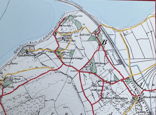
Here is the section of the map showing Arnside in 1862.
For clarity she has coloured the estuary in pale blue and the principal roads in red and the footpaths in yellow.
It is fascinating to see what our village was like 163 years ago.
Comments
Sign in or get an account to comment.


