Lionel Hill - village history
A couple of years ago I was doing some research linked to VE Day for the Parish Newsletter and I found a full set of OS historical Maps on the National Library of Scotland website. We have another event linked to history coming up in a few weeks time in the chapel. I said I would do an activity, so drawing on the kind of ideas I used with schools when I ran the Urban Studies Centre in Wakefield I thought I might try a more active fieldwork event. There won’t be too many takers, so maybe a small group might be interested. So the question might be something like:
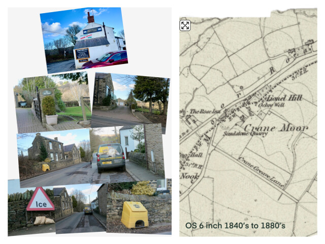
Your map extract shows buildings that were in the Lionel Hill part of the village in 1880. How has it changed since then?
I’ll need an enlarged view if this map so they can see the details more clearly.
Actually most of these buildings that I photographed yesterday are there on the map, though the school and school house are not shown, and The Rose Inn is now the Working Men’s Club.
I might do one or two more areas of the village, maybe starting with the chapel area, as that’s where we’ll meet, and where there has been significant recent building. There is a photo in the local archive that shows the field where the new houses have been built with a small railway trucks where I think they were extracting clay. Ours is a former coal mining area and clay and coal go together.
Yesterday I walked with my neighbour Linda who does this walk fairly regularly so I had company.
Comments
Sign in or get an account to comment.


