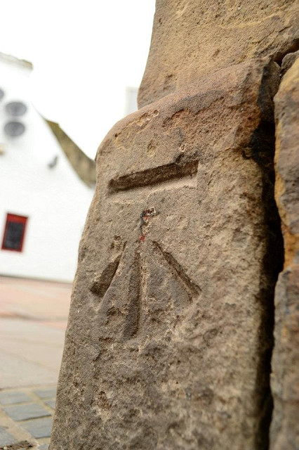
Ordnance Survey Bench Mark.
How many of these have you seen on a building, gate posts, bridges and even on Churches! These are part of the Ordnance Survey mapping, they are used to give the height above sea level specific to it's location , if you've ever climbed a hill of mountain, you'll have seen a concrete structure about 4 feet tall with a brass plaque located near the bottom with a similar mark along with it's unique OSBM No!
Why are these there and who devised the mapping of the UK?
Major General William Roy
1726 - 1790
Surveyor and cartographer. Born at Miltonhead, near Carluke (South Lanarkshire). Following the Jacobite Rebellion led by Bonnie Prince Charlie, Roy was directed to produce a map of Scotland to enable more effective policing of the country. This he undertook between 1747 and 1755 and the hand-drawn result can be seen today in the British Library (London), having been transferred from the British Museum in 1973.
Roy was later commissioned to set up the network on which all subsequent surveying is based, and was commended for the accuracy of his work. Roy had the vision of bringing about an organisation responsible for mapping and surveying in the UK, but the Ordnance Survey was not created until a year after his death.
Roy was also a noted antiquarian, studying Roman remains. His Military Antiquities of the Romans in Scotland was published three years after his death.
147
views
- 2
- 0
Comments
Sign in or get an account to comment.


