Rebridgeration
After being intrigued by a combination of BikerBabe's mile stone blip and flumgummery's summer house by Broxmouth blip, I went trawling old maps of the latter and comparing with Google Streetview, looking for any other remaining mile stones or mile posts. I found a little one purportedly peeking out from the undergrowth near Bilsdean. I would've cycled past it in summer 2021 when I did a tour of East Lothian and Borders, but I wasn't looking for them then.
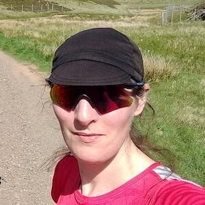
So today in almost sunny but still cold weather I whizzed out on Fidra to the location. The problem was, it's June and the undergrowth is in full swing. I trudged up and down, I doublechecked and triplechecked the location on the map, I even trampled into the brambles, but I simply couldn't find it. The more I study Streetview the more I think I was looking for something that wasn't there: I suspect it was removed to make it easier to mow the verge.
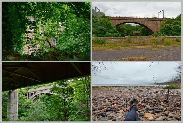
But no matter, on to part two of my itinerary: the collection of bridges over the precipitously edged gorge of Dunglass Burn. This is where East Lothian meets the Scottish Borders, and where the A1 – The Great North Road – is now on its fourth alignment.
Back in the day, 1617 or thereabouts (which just happens to be when James VI visited Scotland) they built an impressive stone bridge over the banks of the Dunglass Burn. Its arch has a ten metre span. The road, if you can call it that, is only just wide enough for a horse and cart, perhaps a stage coach. It's quite overgrown with ivy and you could walk across it now and not even realise you were on a bridge. It's also quite hard to see from nearby.
In 1798 they reckoned they needed a bigger bridge, so they built one a fair way upstream and, with great imagination, called it the Dunglass New Bridge. The original one became the Dunglass Old Bridge. The new one had a 25 metre arch, castellated parapets and everything and you get a good view of it when you're on the train. The railway came along in 1836 with the high viaduct that has a 41 metre arch and is something like 30 metres above the water. But road traffic carried on doing what it does, and the A1 – newly designated in 1921 – was pretty snaky going through the hamlet of Bilsdean and over the gorge, so they needed a new bridge again in order to straighten the road. In 1932, concrete was all the rage, so on the opposite side of the railway they built a new Dunglass Bridge, a rather good, if chunky, design, with a wide deck and good pavements. It feels quite spacious underneath, with nice fluted details that you just don't get these days.
But after only 40 years it started to fall apart. In fact, according to a 1987 report, it required demolishing immediately, so they needed a new bridge all over again. By the 1990s they hadn't got around to knocking anything down, and instead right alongside they put up a modern, boring bridge with tall plain columns and a boring steel girder deck, and they made the newest old bridge nice and safe by, er, installing some bollards at each end.
After photographing everything, I wandered down the path to the beach, which apparently has some sand but it's mostly rounded rocks. I found a spot under a thicket to hide from the rain that was coming, and had a big cup of tea plus the other pastry I bought yesterday, before climbing back up the gorge path. The gorge itself has some amazing weathered sandstone layers that remind you how many millions of years the river has been going at it.
The rain didn't pass overhead, it stayed and soaked everything, and although I'd planned to have a late lunch at Smeaton Nursery I suddenly wasn't in the mood, and instead rode back along a very wet A1 to get home and dried out.
153
views
- 4
- 1
- Nikon D7200
- 1/400
- f/8.0
- 22mm
- 200
Comments
Sign in or get an account to comment.


