
The Changing Landscape
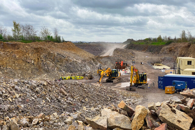
Back at the end of August I posted a shot of a field at the top of our village, which had the remains of a Roman road. The road wasn't going to last much longer because the local quarry were extending into the field. Today I returned to see how things had progressed. And progressed they had!
What you're looking at is the road from Churchend to the Downs Road, except the road isn't there now. Churchend would be to the left of the image, and the Downs Road to the right. In the dusty distance you're looking towards Wickwar, after which the quarry was named.
You can see the footings of a large "cut and cover" tunnel which, when completed, will allow the road to be re-established with quarry traffic running underneath the road. One footing has little orange people all over it, and the other one seems to be a muddy swimming pool at the moment!
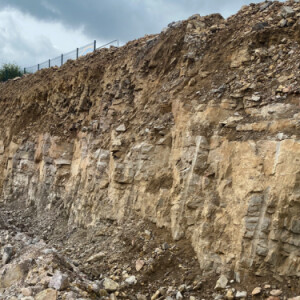
You can also see in the extra the honey yellow stone at the top of the excavated rock face, which is apparently good enough for dry stone walling, and then it quite quickly turns into the larger limestone rock face which is the core commercial component of the quarry.
It is interesting to consider, when we think about our green and pleasant land, that what we're actually talking about is a thin layer of topsoil and woodland. What lies beneath only a few hardy souls are privy to, until they dig it up and haul it out.
Comments
Sign in or get an account to comment.


