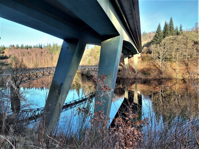
It is almost unbelievable that until 1950 there was a little two span stone bridge here. At the time it crossed the river Tummel until it was demolished when the valley was flooded raising the water level 40 feet (12metres) to create Loch Faskally providing a reservoir and water for the Pitlochry Power station. Shortly afterwards the Coronation footbridge was built close by. Pitlochry used to be a bottleneck on the main road north from Perth to Inverness until a bypass was built in 1981 with the new Clunie bridge crossing Loch Faskally adjacent to the footbridge.
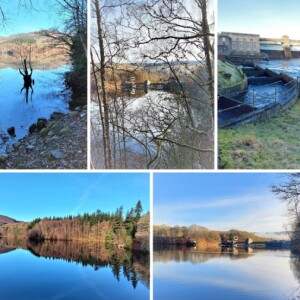
Collage Some stone remains from the bridge marking the steep approach to the bridge can just be seen in the bottom photo below the two tall conifers. The other large photo and middle one show the dam from the woodland path on the western shore and the spider-like thing is the remains of a tree that was probably very tall growing on the hillside before the valley was flooded. As more electricity is required the water levels visibly fluctuate during the day when water is released higher up through other power stations in the vast HEP network. We walked along the wooded shores and watched the swirling waters in the fish ladder which enable migrating fish to traverse the dam each year. The exhibits at the Visitor Centre beside the dam were very informative showing the vast networks of tunnels and dams and effects that they have had on the landscape and communities since the war. Through an interactive display I discovered how difficult it must be to adjust the generation of electricity from the combination of water, oil, coal, wind and nuclear power stations to the National Grid at different times of day so have sympathy for those trying to keep Britain going during these cold days.
With today’s brilliant walking weather we reluctantly left for home but then enjoyed an excellent musical recital in the evening. Tomorrow I should have the chance to catch up on your blips again.
Comments
Sign in or get an account to comment.


