
What it's all aboot
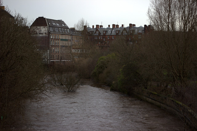
Today's blip shows the River Kelvin in Glasgow at Kelvinbridge in pretty high flow conditions. The Scottish Environment Protection Agency's flood extent maps indicate that the Kelvinbridge car park (the area just out of view to the right) will flood in a 1 in 200 year flood event - thankfully I haven't seen it happen yet!
The Scottish Government in their new legislation on flooding define flood risk as the likelihood of flooding taking place at a given location combined with the consequences of that flood event. So, there could be a very high probability of a flood event occuring but if there is nothing there for it to impact (e.g. homes, infrastructure, businesses etc), the flood risk will be low. Clearly flooding at Kelvinbridge would affect a range of issues including homes and transport infrastructure so the flood risk is pretty high.
My PhD research is, in part, looking at land use and land management based stratgeies located in the middle-upper reaches of catchments for increasing flood storage. This approach aims to reduce flood flows lower down the catchment thereby helping to reduce the likelihood of flooding - this in turn will reduce the overall flood risk.
All in all, this type of whole catchment approach is a cheaper, more sustainable, more resilient and altogether more modern approach to flood risk management and pretty exciting if you're a flooding geek! The work we are doing in Sandyhills Park as part of the Commonwealth Games legacy will hopefully set a precedent for this type of approach in an urban setting.
159
views
- 0
- 0
- Canon EOS 600D
- f/1.8
- 50mm
- 200
Comments
Sign in or get an account to comment.


