
Mystery of the bridge
This morning I went out to run the route that Dan and I walked, yesterday, except that instead of crossing the river at the ford I ran all the way up to Rigmaden and crossed the Lune there.
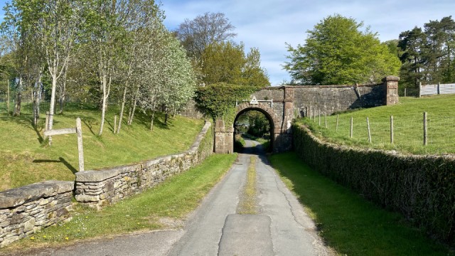
There's a section of the route where you leave the fields of Underley Grange and head first west and then north along Lowfields Lane. And it's on that latter stretch where you will encounter this sturdy looking stone bridge. It looks like a railway bridge, actually, yet it simply connects two fields.
The funny thing is, as you can see from the photo, the field on the right slopes down and would naturally meet the field on the left if the lane hadn't been cut through it. I can see, of course, that the bridge was built to cross the lane but even these days there's barely any traffic along here so surely a little crossroads would have sufficed?
It all became a little clearer when I got home and took a look at a map. The bridge is part of what once would have been a road going directly from Barbon to the bridge at Underley. I guess that in the days before the bridge was closed to the public, that would have been the route to Kirkby Lonsdale from Barbon and the towns and villages along Barbondale to the east.
I'm beginning to wish I had some old maps of the area and, more than that, some information about people's lives with (it would appear) particular focus on the routes they took to get about.
****
-8.3 kgs
Reading: 'Underland' by Robert Macfarlane
Comments
Sign in or get an account to comment.


