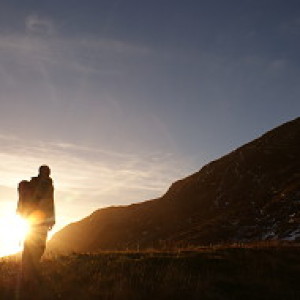
Walking up Dun Caan
Dun Caan is the highest point of Raasay, 443 metres above sea level, but somehow seeming higher. It's topped off by a flat bed of volcanic basalt, more resistant to erosion than the sedimentary rocks around it, and hence standing proud. This gives it a distinctive profile that pinpoints Raasay as you drive through Skye to reach the ferry at Sconser.
We walked up it this afternoon to take in the views from the top. This photo was taken near the summit, and is the first and smaller lochan that is reached on the track that rises from the road. Gus and Wifie were stood at the water's edge, while Alison who had been taking photos, was stood rather like a Gormley statue behind them. Beyond this the path descends into a trough in which there are two much larger lochans, before rising up onto the cap of basalt. On the way up, Sue found some field gentian (Gentianella campestris), a plant I had yet again failed to find on Arnside Knott this year. I said to Sue that she has the advantage of being much nearer to the ground than me, so she tends to spot these things when I don't.
It was another fine day, we spent the morning exploring Holoman island and looking for pellets that the sea eagles might have left below what we called Eagle Rock.
Had we been earlier in our walk up Dun Caan, we might have had a surprise meeting with Captain Bill, who unknown to us was also on the island for a few days, and chose the same day as us to walk up the hill. Knowing him, he was probably up and down before breakfast, whereas we were there late afternoon and watched the sun going down. A real shame we missed him, though.

Comments
Sign in or get an account to comment.


